Categories more
- Adventures (62)
- Arts / Collectables (14)
- Automotive (77)
- Aviation (65)
- Bath, Body, & Health (123)
- Children (6)
- Cigars / Spirits (71)
- Cuisine (66)
- Design/Architecture (22)
- Electronics (63)
- Entertainment (36)
- Event Planning (115)
- Fashion (45)
- Finance (10)
- Gifts / Misc (6)
- Home Decor (118)
- Jewelry (41)
- Pets (3)
- Philanthropy (1)
- Real Estate (16)
- Services (44)
- Sports / Golf (14)
- Vacation / Travel (85)
- Watches / Pens (33)
- Wines / Vines (34)
- Yachting / Boating (67)



Why Can GPS Navigation Errors For Large Trucks Increase Crash Risk On Georgia Highways?

Published
08/25/2026A GPS mistake can become a highway hazard when a tractor-trailer follows a route designed for ordinary vehicles. Georgia DOT warns commercial drivers not to rely solely on GPS because many Georgia roads contain low-clearance bridges. FMCSA has warned that some passenger-car navigation systems may not provide the commercial-vehicle route restrictions available through truck- and bus-specific systems, including low-bridge restrictions.
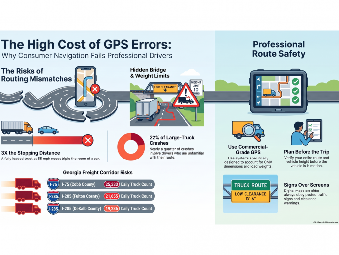
The danger comes from the truck's physical limits. Georgia DDS states that a fully loaded tractor-trailer traveling at 55 mph needs three times the stopping distance of a car. Georgia DDS also explains that large trucks need more room to turn and carry larger blind spots.
Why GPS Errors Create A Bigger Hazard For Large Trucks
Large trucks cannot correct every routing mistake quickly. A passenger vehicle may turn around after entering an unsuitable street. A tractor-trailer may need a much wider turning path, additional braking distance, and a legal route that accommodates its size and weight. Georgia DDS specifically identifies longer stopping distances, wider turning needs, and larger blind spots as major differences between large trucks and passenger vehicles.
FMCSA's Large Truck Crash Causation Study reported that 22 percent of large-truck crashes occurred when CMV drivers were unfamiliar with the roadway. That finding does not establish that GPS caused those crashes, but it shows why an incorrect route can create a meaningful safety problem.
Georgia's Freight Corridors Leave Less Room For Routing Mistakes
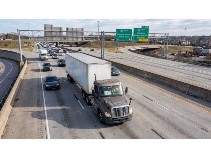
Georgia's major freight corridors carry substantial truck traffic. A Georgia DOT freight report identified an I-75 segment in Cobb County among Georgia's top truck-count locations in 2009, with an average annual daily traffic volume of 281,480 vehicles and approximately 25,333 trucks.
A wrong routing instruction can direct a large truck onto a roadway that does not accommodate the vehicle's dimensions, weight, or turning needs. Heavy traffic can leave large trucks less room to maneuver or stop safely.
Bridge Clearance Can Turn A GPS Error Into A Physical Collision
Bridge clearance creates one of the clearest examples of why passenger-car routing cannot replace truck-specific navigation. Georgia DOT warns commercial drivers to verify vehicle height, obey clearance signs, and avoid relying solely on GPS. Georgia DOT warns commercial drivers to verify vehicle height and obey posted clearance restrictions before proceeding.
As noted by Peter Jaraysi, a Duluth truck accident lawyer and founder of Slam Dunk Attorney, a 2025 Best of Gwinnett Winner, Lead Counsel Verified firm, and named to The National Trial Lawyers: Top 40 Under 40, "Commercial drivers must strictly obey posted height and weight limits rather than relying solely on passenger GPS units. A navigation system won't prevent a bridge strike if the physical clearance falls short of truck dimensions."
Weight creates another routing restriction. Georgia DOT states that posted and restricted bridges impose truck weight limits and require trucks exceeding those limits to use alternate routes. A navigation system that does not account for those restrictions can direct a commercial vehicle onto a route that does not accommodate the vehicle's height, weight, or other applicable restrictions.
Why Last-Second GPS Corrections Increase Crash Exposure
A late route change can require a commercial driver to make decisions or maneuvers under time pressure. FMCSA recommends that commercial drivers plan routes before driving and stop safely before reviewing maps or entering navigation information. FMCSA identifies electronic navigation as a potential distraction when a driver handles directions while the vehicle moves.
Georgia DDS explains why a sudden maneuver can be especially dangerous around a tractor-trailer. A fully loaded tractor-trailer at 55 mph needs three times the stopping distance of a car, while the truck's length also increases the space required for turning. A missed exit followed by an abrupt lane change can be especially hazardous because large trucks require more space and time to maneuver and stop. A truck that enters an unsuitable street may need to stop or reposition before continuing.
Investigating commercial truck collisions requires analyzing electronic logging devices, driver fatigue, and strict federal hours-of-service compliance. If you need to evaluate a truck crash claim in Duluth, Georgia, Slam Dunk Attorney provides cost-free initial consultations. To discuss your options with their team, call (678) 329-9750 or visit 2250 Satellite Blvd, Ste. 120, about a 14-minute drive from North Metro.
Map Data Cannot Replace Posted Georgia Restrictions
A digital route may not reflect every current roadway restriction or condition, even when the map appears current. FMCSA advises commercial drivers to use current map information and to treat navigation as an aid rather than the final authority. FMCSA also directs drivers to obey traffic signs and restrictions when a navigation instruction conflicts with roadway controls.
Georgia DOT continues to develop and fund transportation, freight, bridge, and interchange improvement projects across the state. Georgia's freight plan identifies I-285, I-75, I-20, I-85, and other major corridors as significant freight locations, meaning route conditions can change within a network that already carries substantial truck traffic.
Navigation data may not reflect every current roadway condition or restriction, so drivers must follow current traffic signs and advisories. Posted signs and official roadway restrictions control the legal route.
What Commercial Drivers Should Verify Before A Trip
Pre-trip route verification can prevent a navigation error from becoming a roadway emergency. FMCSA recommends reviewing the planned route before driving and using navigation technology appropriately rather than manipulating the device while moving.
Vehicle dimensions deserve particular attention. Georgia DOT's bridge guidance tells commercial drivers to know vehicle height and comply with clearance warnings. Georgia DOT also provides statewide information on posted and restricted bridges for truck routing.
Route checks become especially significant before a truck leaves I-75, I-85, I-20, or I-285 for a local road. Georgia's freight data shows that those corridors carry substantial commercial traffic, so a wrong turn can move a large vehicle from a controlled Interstate environment into a road with tighter geometry and different restrictions.
When A GPS Error Becomes Relevant To A Truck Crash
GPS information alone does not establish legal responsibility for a collision. The circumstances of the crash and the driver's actions can be relevant when evaluating what happened.
Georgia DOT maintains crash reports and public-road crash data that can help establish crash location and other reported crash details. Georgia DOT's statewide crash-data resources provide public-road crash information for transportation analysis.
The sequence of events can help explain how a navigation error contributed to a crash. Navigation records may show the selected route, while roadway signs and other available records may help establish the conditions the driver encountered.
Georgia highways carry heavy freight volumes, and large trucks have physical limits that ordinary navigation systems may not account for. FMCSA and Georgia DOT both recognize that truck-specific route planning matters.
Comments
